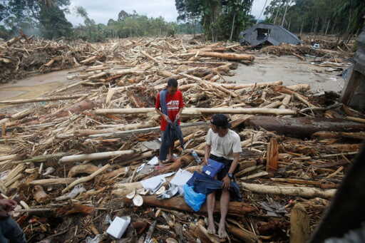
Indonesia’s government has been at pains to stress that the recent catastrophe in Sumatra was triggered by a rare meteorological event. Cyclone Senyar formed in the Malacca Strait, an area where the national weather agency notes such storms are “an extremely rare phenomenon,” before unloading torrents of rain on Aceh, North Sumatra and West Sumatra. Meteorologists say the interaction of two cyclones may have produced record rainfall over parts of the island. Scientists are cautious about pinning any single storm on climate change. Yet few now argue that the tragedy was simply an act of nature. Men stand on logs swept away by flash flood in Batang Toru, North Sumatra, Indonesia, Tuesday, Dec. 2, 2025. Photo credit: AP Photo/Binsar Bakkara Officials themselves have begun to say the quiet part out loud. Forestry minister Raja Juli Antoni told parliament that “poor forest management” had worsened the disaster, and promised to “review forest governance, consider a moratorium on new permits, and revoke the licenses of violators,” according to Reuters. The environment minister, Hanif Faisol Nurofiq, has suspended permits for several companies in the Batang Toru watershed and warned that criminal proceedings are possible if violations are found. The broader pattern is well documented: Sumatra has lost an estimated 4.4 million hectares of forest since 2001. When the floodwaters receded, viral images showed how extensive clearing shapes disaster impacts on the ground: houses smashed by logs, riverbanks lined with cut timber, and whole slopes stripped to bare soil. Annual primary forest loss in…This article was originally published on Mongabay
From Conservation news via this RSS feed