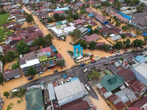
JAKARTA — Flooding disasters in Indonesia are increasingly traced not to natural causes, but to corporate destruction of peatlands, NGO Pantau Gambut warns in its newest report. The report reveals how the construction of industrial-scale canals, not just haze, poses a growing threat. Pantau Gambut says its new report builds on earlier findings that peat degradation drives floods. That previous analysis warned that nearly half of Indonesia’s peatlands, about 6 million hectares (15 million acres), were classified as highly vulnerable to flooding due to unchecked land degradation. The new report goes beyond diagnosis of flood risk to trace responsibility directly to corporate concessions and weak laws. The report found that 281,253 kilometers (175,000 miles) of canals have cut through peatland ecosystems across Sumatra, Kalimantan and Papua. Map of peat canals in Kalimantan. Image courtesy of Pantau Gambut. The total canal length — equivalent to roughly 65 trips between Los Angeles to New York — is mostly found within oil palm concessions and industrial plantation forests, covering areas of nearly 4 million hectares (9.9 million acres) and 2.5 million hectares (6.2 million acres), respectively. Draining peat via canals compromises its sponge-like function, causing subsidence and irreversible drying, according to Kitso Kusin, a peat researcher at the University of Palangka Raya in Central Kalimantan province. Once peatland loses its permanent ability to retain water, there will be uncontrolled runoff that damages the surrounding environment. Therefore, floods in degraded peatlands aren’t “natural” but a sign of hydrological collapse caused by drainage canals, deforestation…This article was originally published on Mongabay
From Conservation news via this RSS feed
You must log in or # to comment.