
All images by Katie Fite.
Remember those lines during the Bush 2 Iraq War days about empire, we’re creating our own reality, and something about history, too? This strikes me as the BLM and the USFS credo, after decades of huge infusions of federal fuels and “restoration” funds. They’ve created a vast public land manipulation empire, a Treatment-Industrial Complex, based on industry-serving range myths, deranged vegetation models and denial of history.
Each new big Congressional appropriation boosted by fire fears expands this empire and more of the West is laid waste. So does each new rollback of environmental laws and policies. These combine to increase agency arrogance, perverse ecological ignorance, deceptive language, overall dishonesty, and destructiveness as Steve Kelly relates in his article on forest genocide.
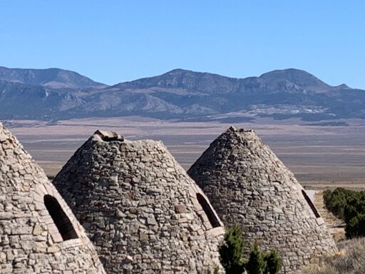
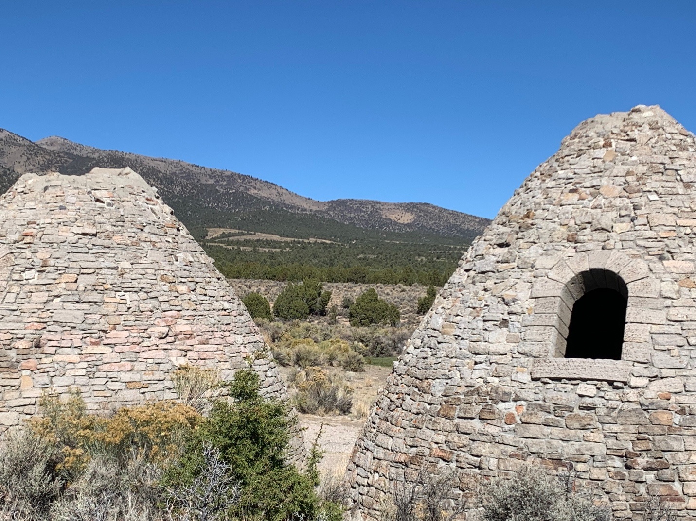
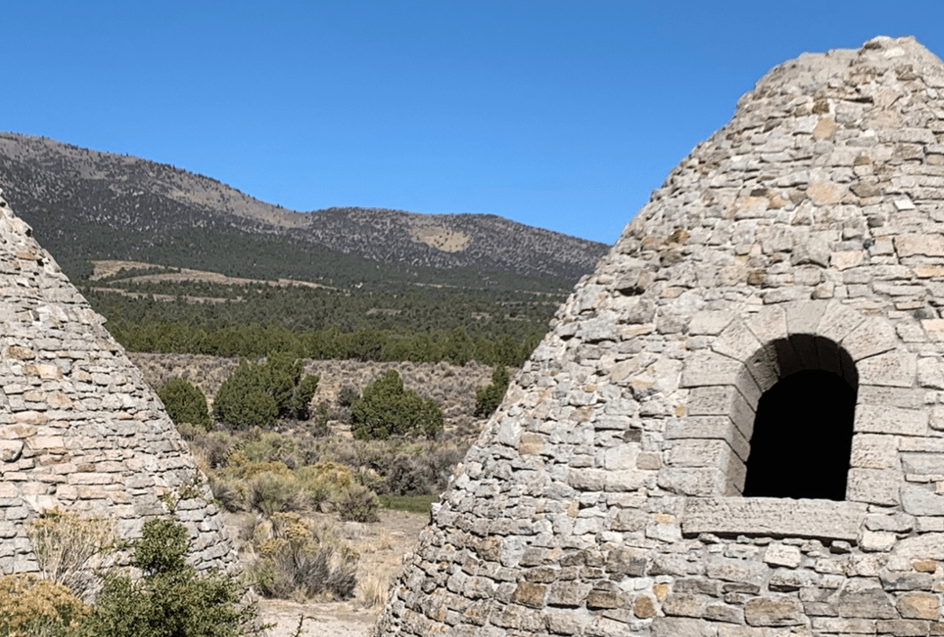
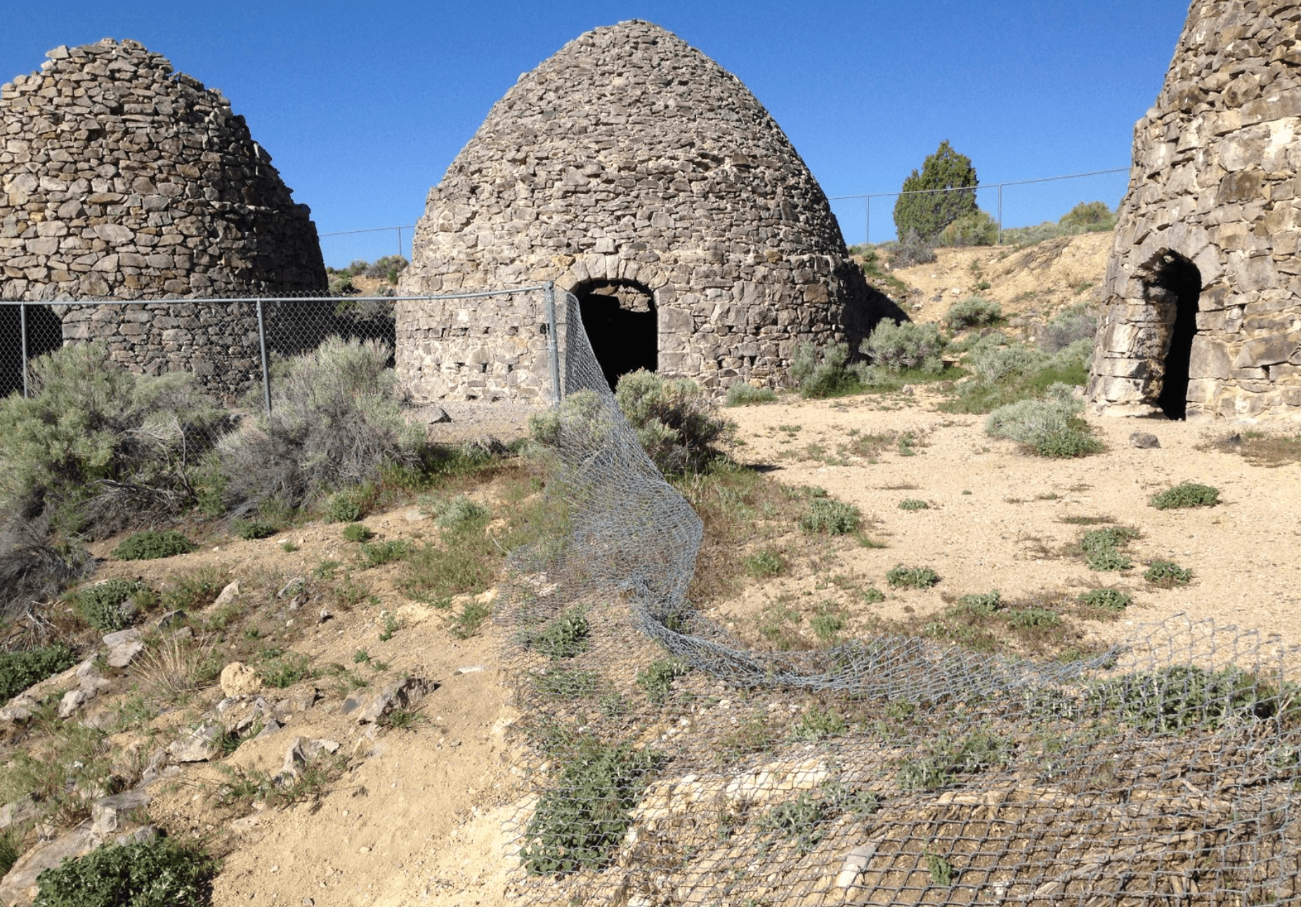
The Ward Charcoal Ovens state land historical site in the Steptoe Valley south of Ely Nevada exposes the blather the public is fed in NEPA analyses, and media articles that take everything agencies say about Pinyon-Juniper forests as gospel. The Ward ovens are testament to what happened to the land and its forests during the 1800s mining boom. The ovens stand as a thumb in the eye of BLM’s eradication empire.
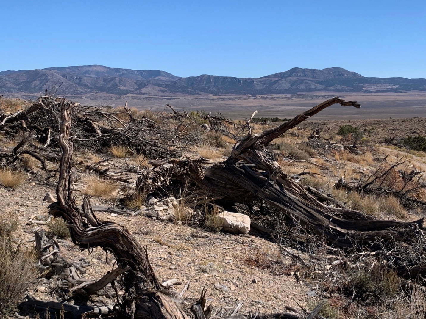
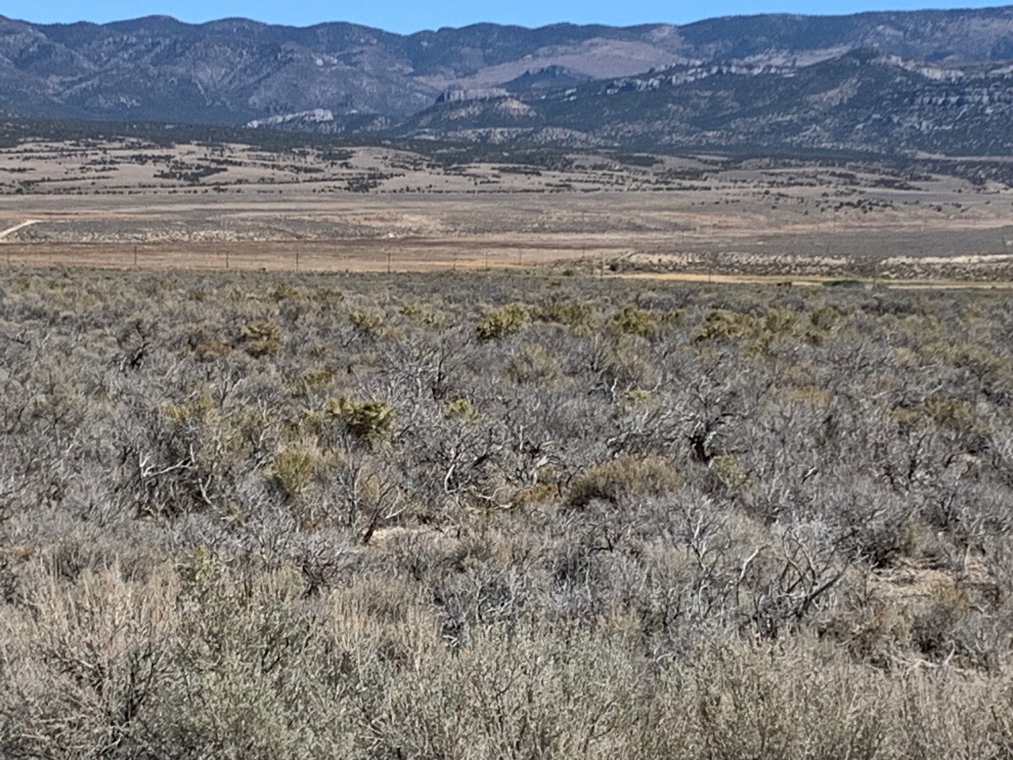
The photo above is looking from the ovens by the Egan Range across south Steptoe Valley to the Schell Creek Range in the east. Pale areas have suffered fresh PJ clearcuts and sage thinning – so very well thinned sensitive bird species can’t find a place to nest. Big ugly cleared swaths of forest are visible all along Highway 93, and up over the pass towards Spring Valley.
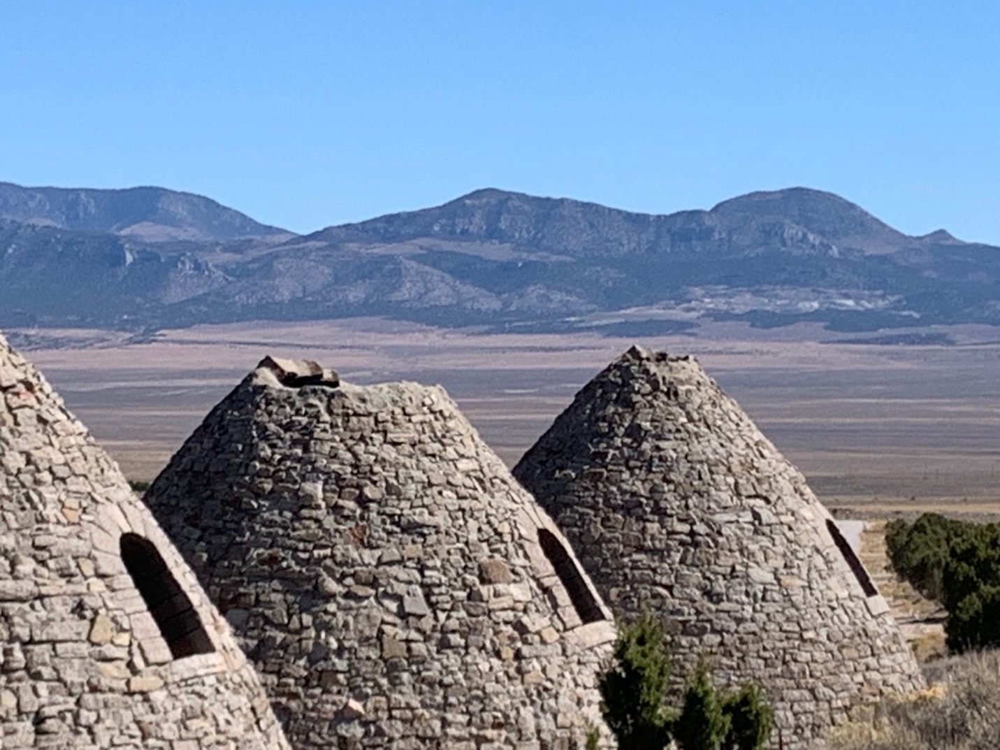
In this photo, new cleared areas in the Egan Range are visible beyond the tree patches left by the Ward site.
Egan Range Chaining, Cutting, Mastication
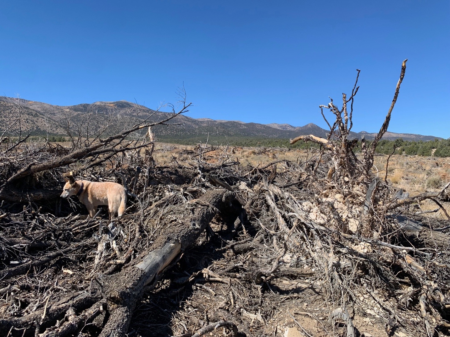
Bulldozer chained, bull-hogged, masticated and cut areas lie all along the foothill fans, slopes and benches of the Egan Range, extending north to Ely. Between the remaining trees lie innumerable cleared expanses. BLM has wiped out much of the forest that was recovering from the mining era.
In the early 2000s, Ely BLM unveiled a major Ely-Mount Wilson Wildland Urban Interface (WUI) project in the Steptoe landscape and a separate area 90 miles south by a summer home site near Pioche. As is common with WUI projects, BLM strayed far afield from homes. After a legal challenge, BLM backed down and agreed in a settlement to limit the project to the Mount Wilson access road and house areas, and right by Ely. But when BLM is beaten back by environmentalists, they later segment smaller projects into the same area that are harder to challenge. This also shifts the denuding more subtly, so tree loss is less noticeable to the public.
Forest ecologist Ron Lanner, author of The Pinon Pine, The Bristlecone Book and Trees of the Great Basin assisted in the legal effort. For years, he was the sole academic voice doing battle with agency forest assassins, and the deceptions of land grant school range researchers who cast themselves as tree specialists. Those folks talked out of both sides of their mouths. They claimed they really did care about the trees, as they sucked in research dollars to find ways to kill the trees better and justify more deforestation. Maybe that should be dewoodlandization, because rule number one of the range gang was to never grapple with PJ as a forest, and instead conduct a constant smear campaign about flammable, water-sucking, too dense encroachers – basically weeds.
Rule number 2 was to ignore or deny history and the impacts of white settlement and colonization, because that didn’t fit with their long-cultivated invasion and encroachment narrative that has long benefited the public lands livestock industry. Lanner was an ecologist who wrote about and spoke up for the trees and read the historical record. The others got rewarded with lots of research funds, agency contracts, and tree-bashing publications in journals.
TNC has been deeply involved in work facilitating PJ removal across the Great Basin. They’ve garnered lucrative contracts for 20+ years in support of this. I remember going to Mount Wilson to meet with BLM after they settled the WUI legal challenge. There was a sole BLM staffer, and a much too-friendly TNC representative who seemed to be steering the project. In those days, I didn’t understand how deeply involved in forest destruction TNC was becoming.
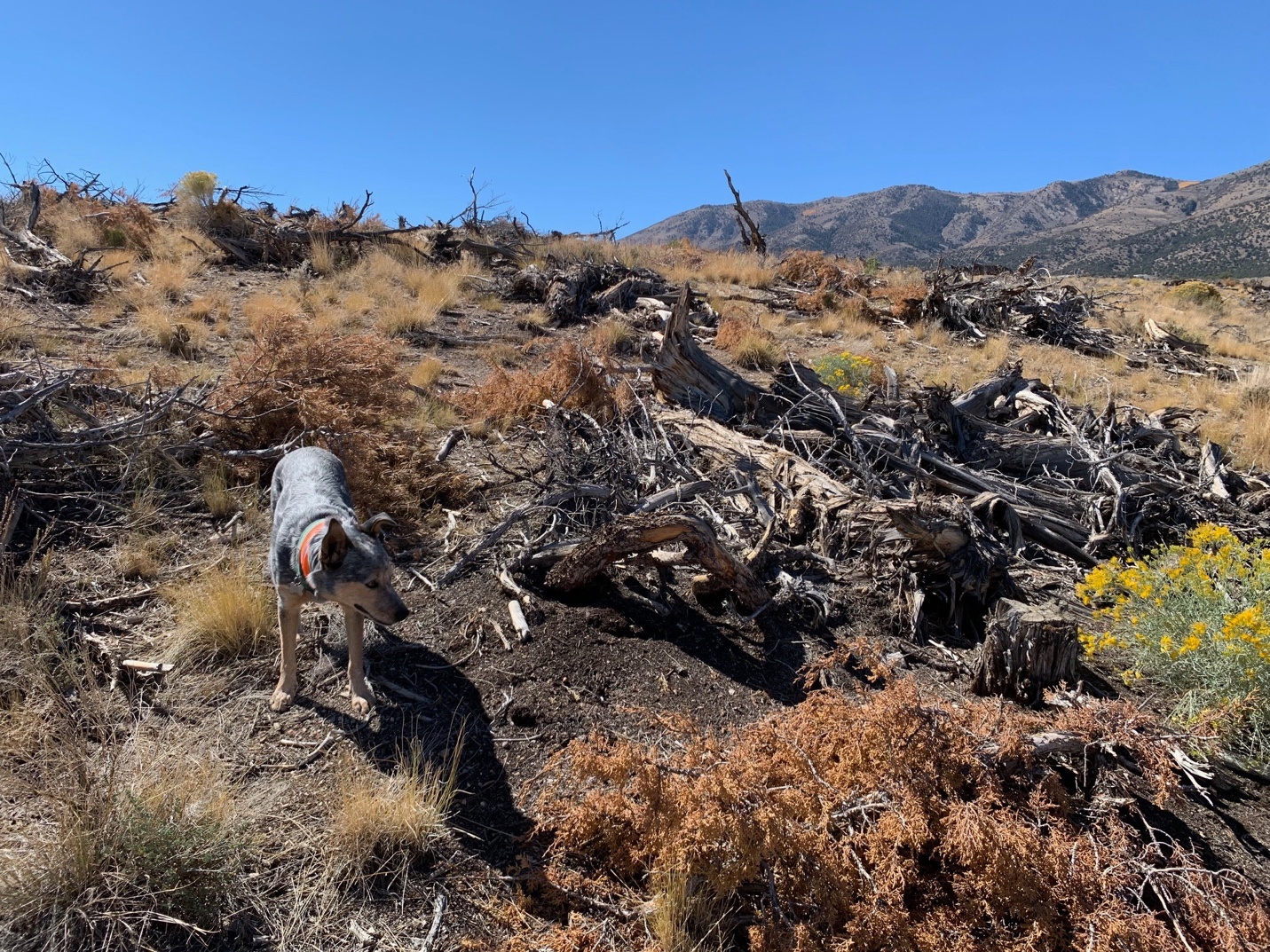
Photos below are from fall 2025 north of Ward, in an area chained in 2018. Maps show it as a “FIAT” project based on bulky reports BLM used to justify not listing Sage-grouse. The public was assured that if millions of acres of trees and dense sage were dealt with, the birds would thrive. They never mentioned Pinyon Jays and biodiversity loss as collateral damage.
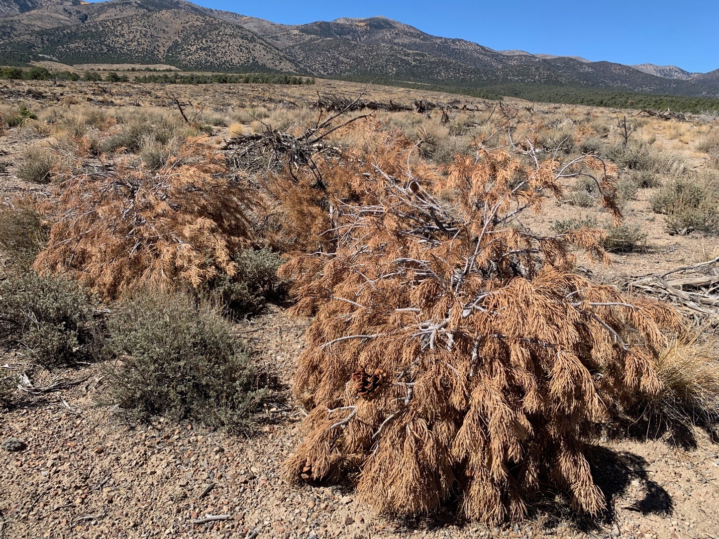
Why would a chaining project, with trees violently torn from the earth 7 years ago, still have limbs with brown needles? It turns out those aren’t limbs – they’re small trees that had escaped chaining death. They were freshly killed with chainsaws last year. I wonder how old the limb-sized trees were, perhaps 60-70 years?
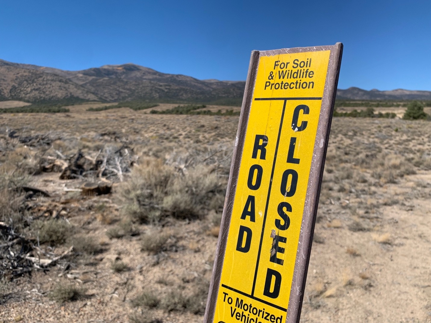
Signs by chaining contractor-created routes, because BLM cares about soil and wildlife.
Like a Pestilence
BLM and the Forest Service turn a blind eye to the scale and impacts of wood removal in the 1800s. Surviving sites like Ward are the most visible reminder. Charcoal pits are less conspicuous, but much more abundant. From Charcoal’s Role in Nevada Mining and Forest History: Charcoal Pits.
For those who know what to look for, the remains of these pits are relatively easy to recognize in the woods: they are circular areas [30-40 ft. across] that still contain charcoal residue and are always located on very flat, level ground. The word pit is a misnomer; a charcoal pit is entirely above ground, built on a clean, level surface called a hearth”.
Here’s another account, relevant to the new Cedar City BLM PJ killing proposal in Pine and Hamlin Valleys. Once again there, BLM clutching onto TNC reports, is trying to delude us into believing PJ encroachment is afoot, and not natural tree re-occupation and forest recovery from past human disturbance or fire. Staff no longer have to think, they just point to outsourced modeling. From Charcoal and its Role in Utah Mining History” :
“Though the charcoal industry has only a small place in state history, it had a huge impact on Utah’s forests, altering and reshaping them. As one observer put it, charcoal production swept “over the West like a pestilence, leaving behind tens of thousands of acres stripped of timber.” The use of charcoal by the smelters had consequences beyond the fuel supply and charcoal prices. Mining meant that demand was heavily concentrated in certain areas of the state, and most of Utah is not heavily timbered. Forest devastation was reported in some areas, and concern developed for the long-term wood supply for mining, commercial, and private uses. One 1873 report noted that:
“The unrestrained use of the timber by the miners and Mormons is working its speedy destruction. It is not only cut freely for the mills, but for making coal, and immense quantities are annually consumed by forest-fires, the result of carelessness or neglect, or of willful determination to destroy. It is abundant now, but in a few years will be very scarce and valuable”.
That 1873 Utah report adds to evidence of significant settler burning decimating the forests, along with woodcutting. Other sources document promiscuous burning by sheepherders and cattlemen to increase spring grass green up. A reasonable person (or honest federal agency or scientist) would consider the possibility that this had a major impact on trees, forest cover, and evidence of fire frequency.
Photo above is at the Frisco ovens above the Wah Wah Valley., a decade ago. Perhaps the fence has since been fixed?
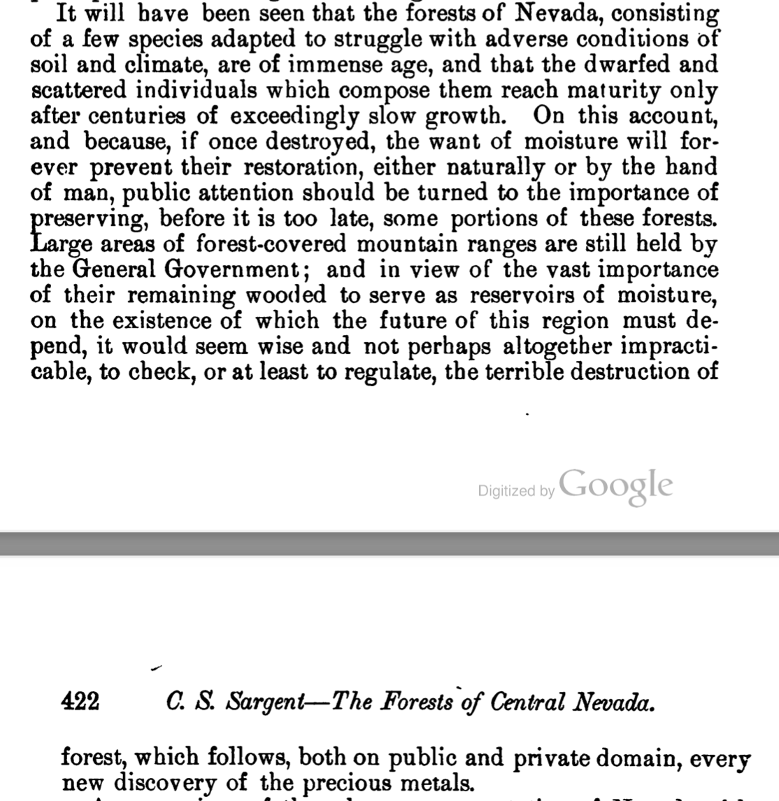
Sargent in 1879 feared for the Nevada PJ forest’s fate:
John Muir wrote 1870s accounts of Nevada travels later compiled in Steep Trails:
“The entire state seems to be pretty evenly divided into mountain ranges covered with nut pines and plains covered with sage – now a swath of pines stretching from north to south, now a swath of sage; the one black, the other gray; one severely level, the other sweeping on complacently over ridge and valley and lofty crowning dome”.
He specifically mentions the Hamilton mining area, right by Ely. Here he describes October in the Great Basin:
“The grand nut harvest is over, as far as the Indians are concerned, though perhaps less than one bushel in a thousand of the whole crop has been gathered. But the squirrels and birds are still busily engaged, and by the time that Nature’s ends are accomplished, every nut will doubtless have been put to use”.
And: “The day was full of perfect Indian-summer sunshine, calm and bracing. Jays and Clarke crows made a pleasant stir in the foothill pines and junipers”.
Those would be the foothills where BLM today is spending many millions of dollars to eradicate Pinyon Jay and Clark’s Nutcracker habitat, quietly driving these beautiful birds towards extinction. Nutcracker populations have also been hit hard by Whitebark Pine die-off at higher elevations.
Here’s an anecdote about the abundance of charcoal pits: When Battle Mountain BLM was plotting its Seven Mile deforestation project across the Antelope Range south of Eureka around 2008, I overheard their archaeologist talking in hushed tones about all the charcoal pits they’d found when doing clearances. But neither plentiful pits nor historical accounts of Eureka Carbonari woodcutting ranging out 50 miles from town changed a bit of their environmental analysis. The trees were encroaching fire-hazards, bad for wildlife, and must be gotten rid of. Why believe history when you can fall back on range tree-bashing and fire fears?
The Seven Mile project was also a WUI scam. It originated with a BLM cattle permittee, ostensibly to protect the Urban Interface of a couple of ranches. My experience with BLM PJ killing projects is that they’re a stack of lies, from start to finish.
A decade after finalizing the project – BLM was still treating away killing and piling PJ then torching piles when the wood dried. But that’s not enough manicuring for the treatment empire. The pile burns are a prelude to landscape burns. Then grass is seeded for cattle.
These projects are erasing expanses of PJ forests recorded in 1800s naturalist accounts from the land, and from memory. We are to accept scattered tidy civilized patches of thinned trees as the norm.
Ever-adaptive in spinning yarns to achieve their ends, and in obvious response to a Pinyon Jay listing petition, BLM claims they’re actually helping. The birds use edge at times, and BLM’s making more. Cedar City BLM said this on a recent field tour of the proposed Indian Peak tree massacre in the Pine and Hamlin Valley region. This is like the Elko BLM claims of helping Jays by feathering forests that I wrote about here.
Another thing mentioned on the Indian Peak tour: BLM archaeologists are using catastrophic fire hype to persuade Tribes that BLM mechanical treatments are needed to protect cultural sites, and that BLM’s mechanical methods are more benign than fires. Methods like bulldozer chaining, heavy equipment masticators, and clearcuts plus pile burns, followed by tractor grass seeding with Amazon drills?
An Agency Culture Steeped in Eradication and Extermination
Chaining the forest by Ward, then coming back and killing little trees that survived the uprooting is classic BLM – a straight line of environmental devastation that runs from the agency’s inception (and much earlier), through political administrations, up to the abysmal present. BLM was formed by combining the Grazing Service and General Land Office in 1946. The General Land Office was established in 1812 – “responsible for all public land sales, patents, and entries, established within Treasury Department to oversee disposition of ceded and acquired lands”. It was a vital part of taming the frontier, wiping out the indigenous population and subduing wildness.
Here’s BLM’s 1946 Logo. Nothing much alive on the land except people. That big wrench, though, conjures thoughts of Ed Abbey’s antidote to the evils of Interior.
I just roll my eyes at talk of reforming BLM someday. No. It’s impossible. There’s an agency culture and legal framework placing hard-core land exploitation above anything to do with land/water/biota/wild places. Look at how BLM has done “renewable” energy. Like the obscenity of the Ivanpah solar plant that burst on the scene around 15 years ago and is now being torn down. But not after destroying the Ivanpah Valley and prime Desert Tortoise habitat, and frying innumerable birds in flight with “death rays”. Birds fell out of the sky as flaming “streamers”. Or look at the Ely Golden Eagle killing Spring Valley wind farm built right by a renowned Townsend’s Big-Eared Bat cave. It looms over the Swamp Cedars massacre sacred site, by Great Basin National Park and its Dark Sky area. Then there’s BLM under Tracy Stone-Manning in the Biden years – filled with merciless bulldozing of ancient Mojave plant communities and Tortoise Burrows, and a new plan to expand industrial solar across 30 million more public acres – which in sudden retrospect now seems all about billionaire AI data center energy greed. The Biden BLM embraced PJ and sage killing projects and grazing proposals initiated under Trump and moved them forward unaltered. They gave out huge sums of IRA funds for deforestation treatments – and funneled large amounts to TNC who is so deeply interwoven with the public land treatment empire.
Land destruction is cemented in Interior’s internal legal system and regulations, and is carried out by staff steeped in “natural resources” exploitation. It’s no wonder that public land and wildlife enemy Mike Lee has a new Bill to move the Forest Service with its own tree killing and grazing crimes against nature to laxer Interior. If anything is left of BLM post-Trump, it shouldn’t be glued back together. Abolish BLM. Create a new agency, mission and legal framework based on preservation.
Tracking Projects and Wildfires
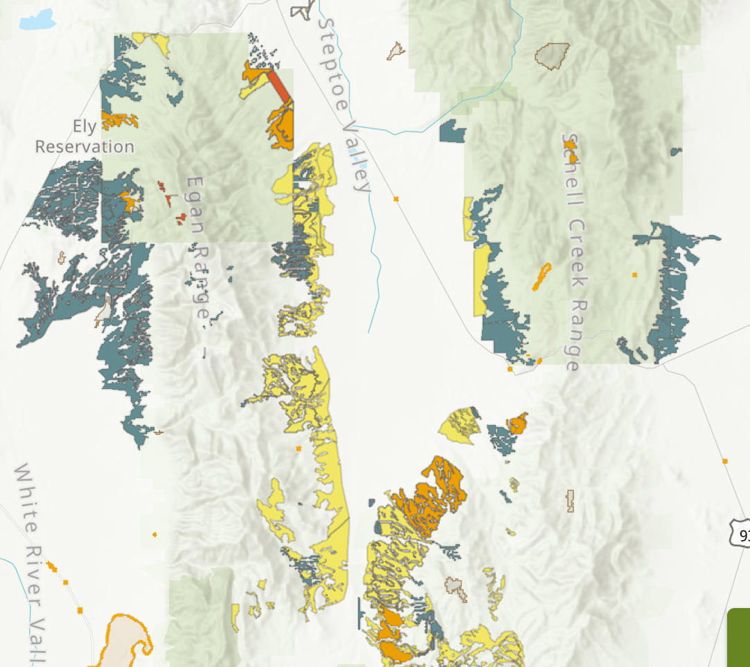
A ReSHAPE TWIG viewer website from the Southwest Ecological Restoration Project shows recent wildfires and federal veg projects. I’m not sure how far back it goes – maybe 25 years max? There’s variation between places in veg information completeness. It doesn’t show the 1950s-1990s public lands tree and sage eradication for cattle seedings. It is quite eye-opening, though. In the Ward landscape, treatments are piled on top of treatments. And look at all the veg projects on the western border of the Egan Range (far left) eradicating foothills forest. I’d love to see the costs with each project.
The Ward chainings were based on BLM’s FIAT scheming, along with a tree damning Steptoe Watershed Assessment. I walked in some of them in spring 2018 right after they were done, In places, a bullhog (really nasty type of bulldozer-tracked mastication wood chipper machine) was devouring PJ forest and bird nests, as Chris Ketcham described in This Land. Lower slopes of these Ely mountains have been ripped apart.
Now the Humboldt-Toiyabe Forest’s new Fire EA threatens higher elevation PJ and other native communities modeled as “uncharacteristic” and “departed” across Nevada and eastern California.
View across the Steptoe Valley at the former forest in the Schell Creek foothills. BLM’s been nurturing Pinyon Jays and Nutcrackers by removing their pine nut food source. The dead gray sagebrush in the photo foreground near Ward sure looks like the death patterning of Tebuthurion herbicide killed sage. BLM is making the land more likely to burn. PJ forests are resistant to burning, except under extreme conditions. However, more fires do help build the treatment empires.
Meanwhile Grazing Grinds On
Back when BLM openly admitted that cattle and sheep grazing was the reason for their tree and sage eradication, excuses weren’t made about fuels reduction or claiming to save Sage-grouse.
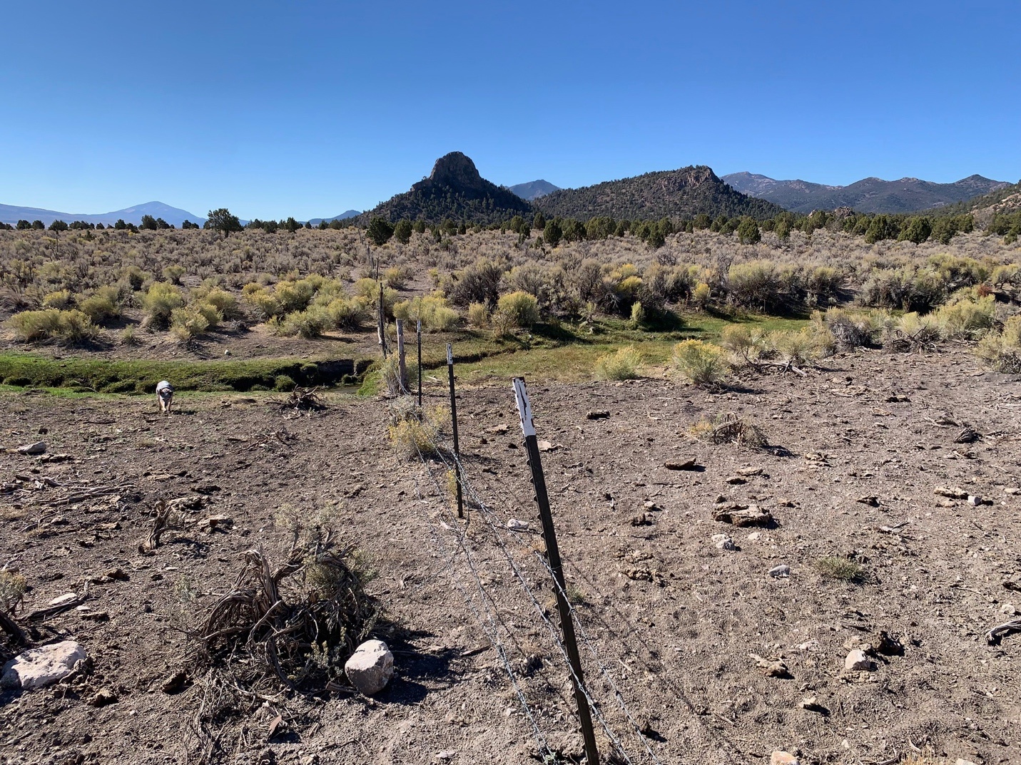
The Ward state land boundary fence, with top wires scrunched down so cows can access both sides of the fence. I’m not sure if the Ward site is officially to be grazed – but I can tell you that cows or cow sign have been omnipresent when I’ve visited over decades. One time there was a cow flop in the middle of an Oven.
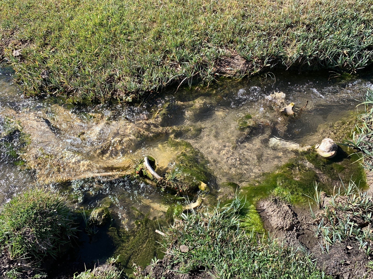
Good luck if you’re looking for clean water in Nevada. Cow bones in the little stream by the Ward site. There’s a husk of a dead cow off in the sage.
And if you get anywhere near livestock water trough sites, trees (the ones that haven’t been cut down) are hanging on for dear life. Cows, like wildlife, seek cooling tree shade and shelter – and compact the soil, batter and rub on the trees, and loaf under them.
The post Bureau of Land Management Eradicates History and our Memory of Forests appeared first on CounterPunch.org.
From CounterPunch.org via this RSS feed